Roof & Storm Damage · Middle Georgia
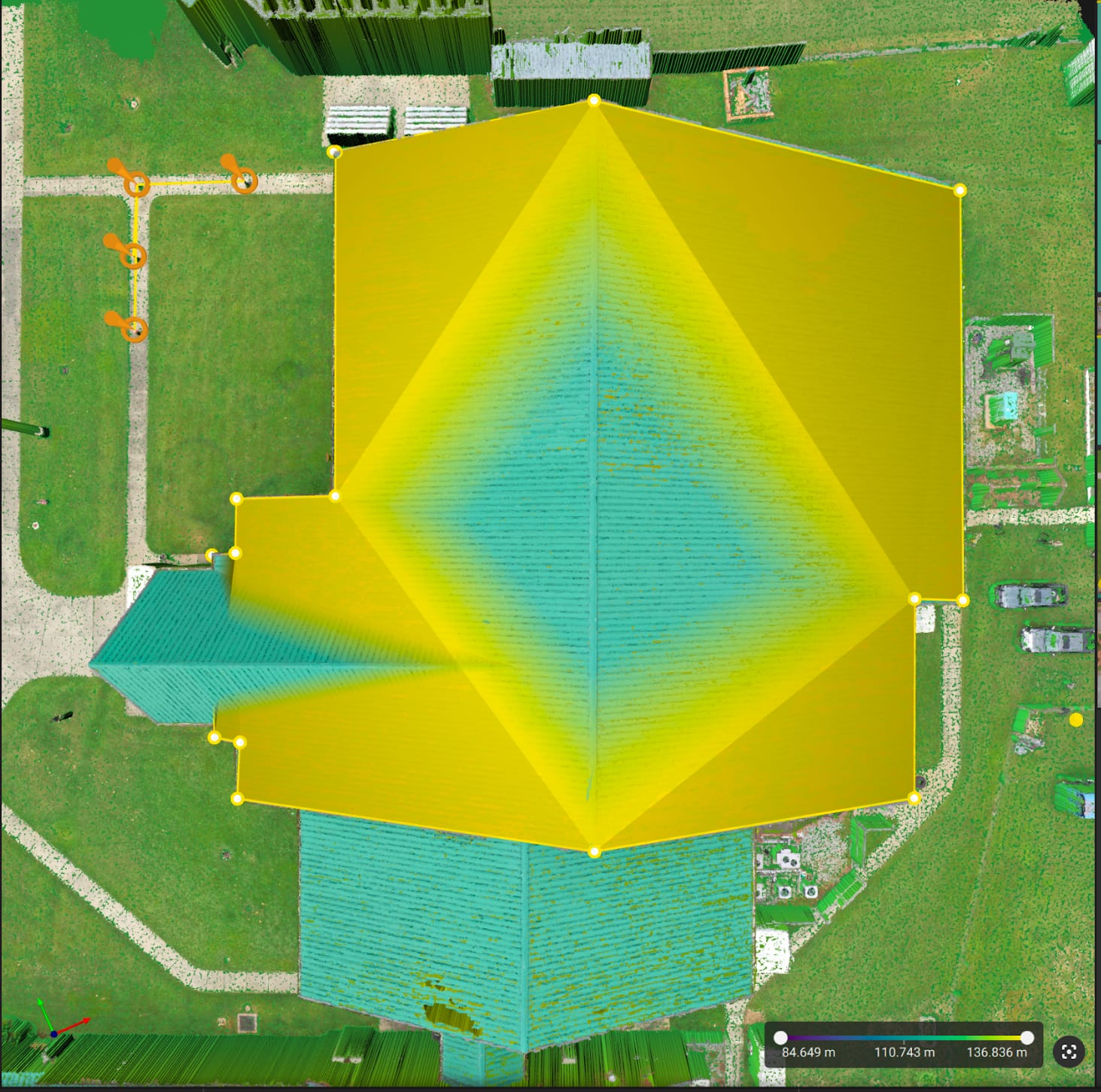
Roof measurements from a 3D model
Elevation-colored roof model with point-to-point distance measurements, produced without anyone setting foot on the roof.
Nobody should climb a damaged roof to find out what's up there. We capture the whole roof, every slope and penetration, in minutes and hand you a documented set that a roofer, adjuster, or property manager can work from.
A ladder inspection covers what one person can safely reach. A drone covers the whole roof, including steep pitches, multi-story sections, and areas around equipment, without anyone stepping on damaged material. You get a consistent record of the entire surface, not a sample.
VECTR documents. We capture clear, complete imagery and organize it so the people making decisions can see exactly what’s there. We don’t determine whether damage is covered, what repairs are required, or what a roof is worth. That stays with your roofer, adjuster, or inspector, and our imagery is built to make their job easier.
Middle Georgia gets its share of hail and wind. When a storm comes through, we prioritize documentation flights so you have a dated record before repairs begin. Tell us where the property is and when you need it, and we’ll find the weather window.
VECTR collects and documents. Determinations about condition, value, coverage, or compliance are made by your engineer, surveyor, inspector, or adjuster.
Tell us what you're trying to accomplish, where it is, and when you need it.
Start a requestPricing
One project. One clear price. Quality without compromise. Every project gets a flat, upfront quote based on size, complexity, location, and deliverables.
Starting at $275
All prices are starting rates. Every project receives a customized, upfront flat-rate quote based on property size, complexity, location, and agreed deliverables. No hourly billing or unexpected flight-time charges. Reasonable additional collections needed to meet the original agreed scope are included when safely and legally feasible. Changes to scope are quoted and approved in advance.
Related work
Elevation-colored roof model with point-to-point distance measurements, produced without anyone setting foot on the roof.