Mapping & Photogrammetry · Middle Georgia
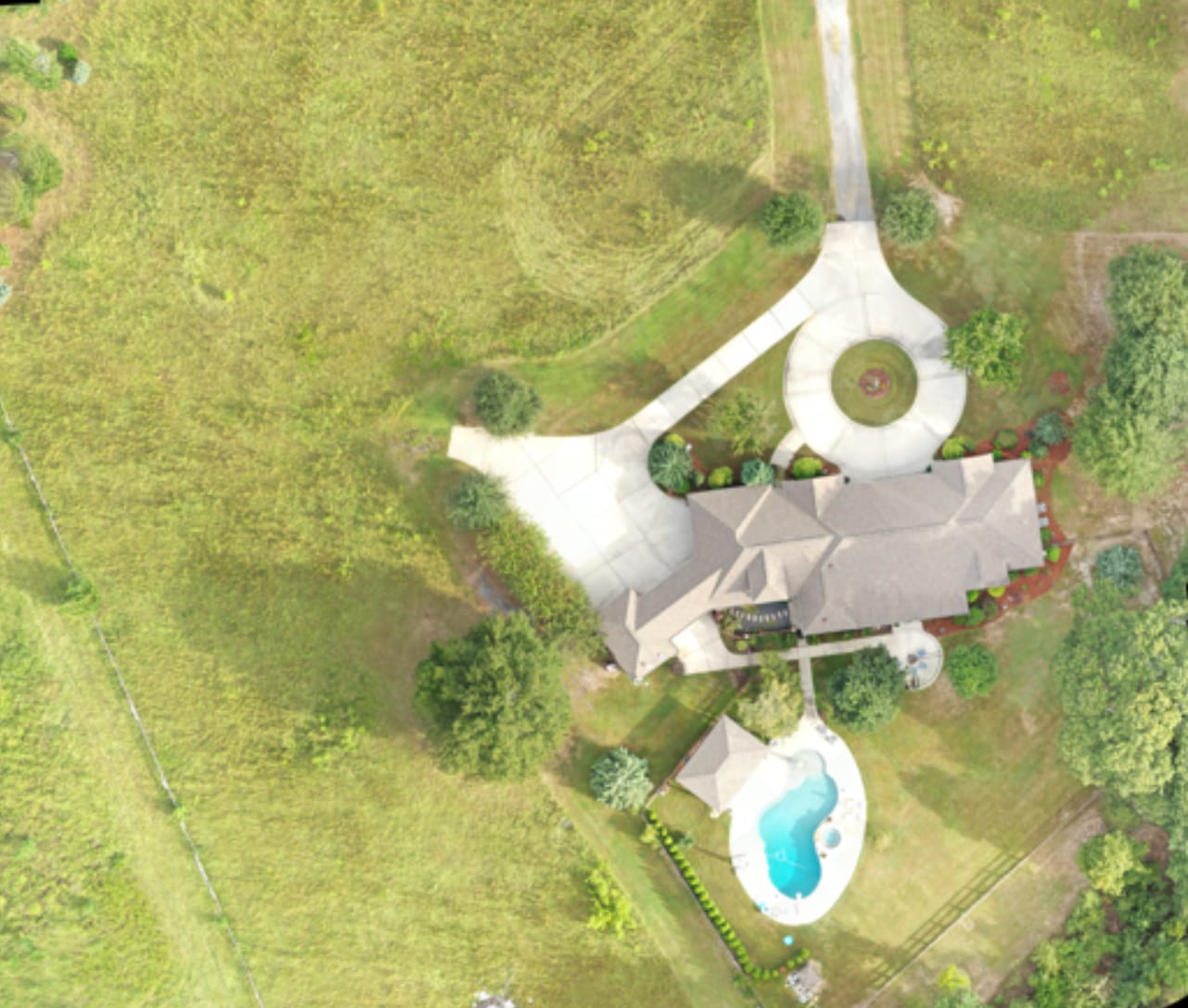
Residential property orthomosaic
Stitched from overlapping nadir imagery into a single measurable top-down map of the house, drive, pool, and surrounding acreage.
Hundreds of overlapping images, processed into a single measurable map or a 3D model of your site. Useful anywhere a sketch or a satellite image isn't current or detailed enough.
An orthomosaic is a single, top-down image of a site stitched from hundreds of overlapping aerial photos and corrected so that scale is consistent across the whole map. It’s far more current and detailed than satellite imagery, and you can measure on it.
The same capture can produce a textured 3D model of the site, a surface model, and contours. From those we can calculate stockpile volumes, cut and fill estimates, and areas. Accuracy depends on capture method and ground control, and we’ll be upfront about what the data can and can’t support.
Photogrammetry deliverables are measurable and useful for planning, tracking, and visualization. They are not a legal land survey, and we are not surveyors. When your project needs survey-grade or certified results, we can capture data to your surveyor’s or engineer’s specifications so their work goes faster.
VECTR collects and documents. Determinations about condition, value, coverage, or compliance are made by your engineer, surveyor, inspector, or adjuster.
Tell us what you're trying to accomplish, where it is, and when you need it.
Start a requestPricing
One project. One clear price. Quality without compromise. Every project gets a flat, upfront quote based on size, complexity, location, and deliverables.
Starting at $499
Starting at $749
Custom quote
All prices are starting rates. Every project receives a customized, upfront flat-rate quote based on property size, complexity, location, and agreed deliverables. No hourly billing or unexpected flight-time charges. Reasonable additional collections needed to meet the original agreed scope are included when safely and legally feasible. Changes to scope are quoted and approved in advance.
Related work
Stitched from overlapping nadir imagery into a single measurable top-down map of the house, drive, pool, and surrounding acreage.
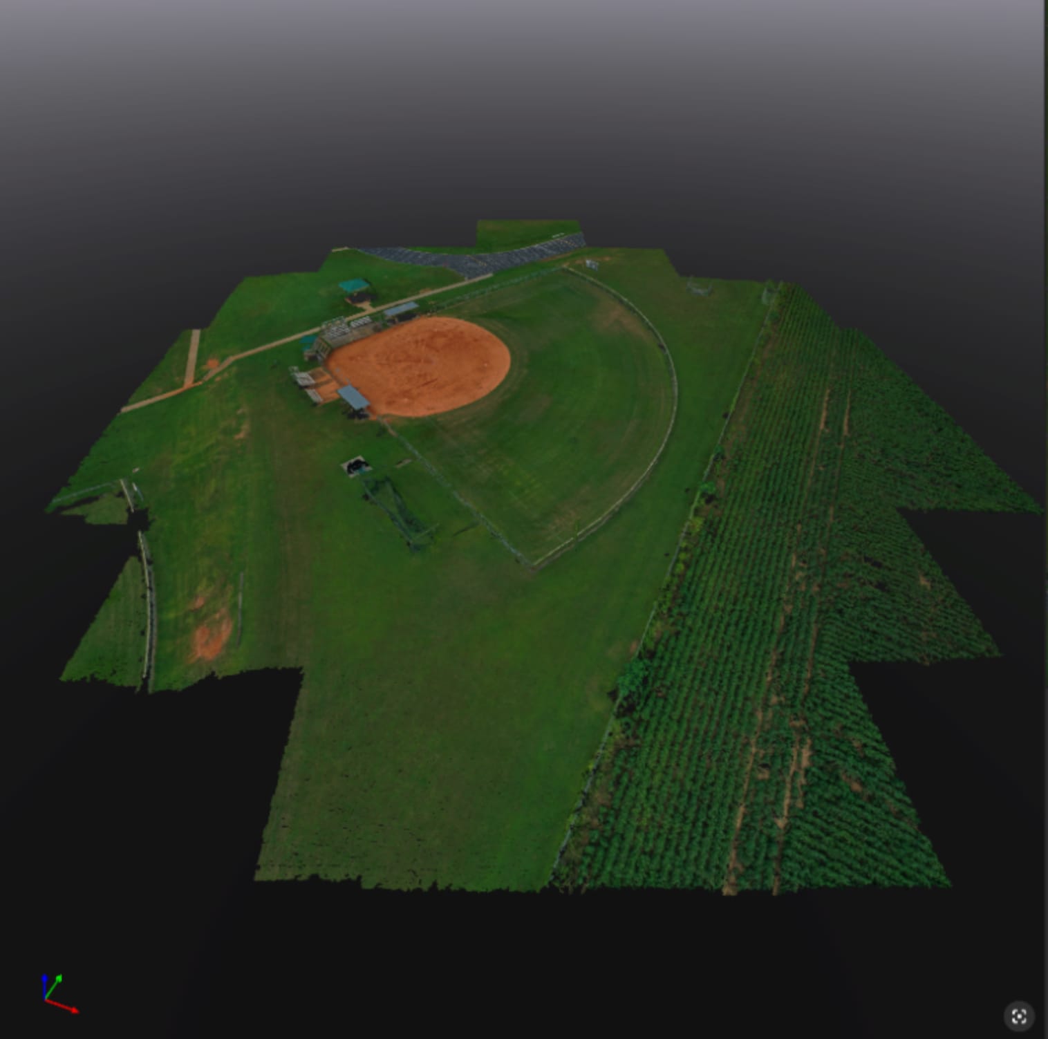
Photogrammetric point cloud of a ball field and surrounding tree line, the basis for 3D models and surface measurements.
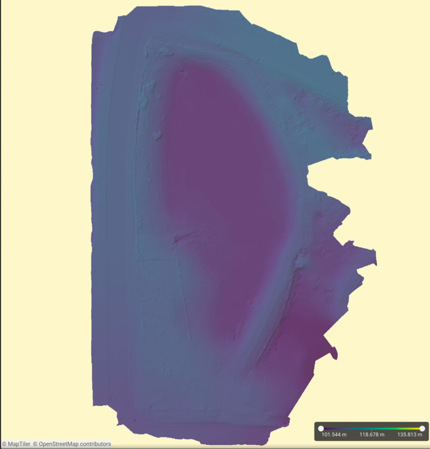
Elevation surface derived from the same flight as the orthomosaic, with a color scale for height across the site.