About VECTR
Flown like an aviation operation, because it is one.
VECTR Systems exists to collect imagery and data from places that are difficult, expensive, dangerous, or slow to reach from the ground. The aircraft happens to be a drone. The approach comes from aviation.
Who's behind it
VECTR is owned and flown by Michael Stevens, an FAA Part 107 certified and insured remote pilot with a background in aviation, avionics, aerospace, and unmanned aircraft systems, both in the field and in the classroom. That background shapes how every job is handled: airspace is checked before a quote goes out, weather gets a real decision instead of a hopeful one, and every flight has a plan.
The company is small on purpose. You talk to the pilot, the pilot plans the job, and the pilot delivers the results. That makes a simple job simple to book, and it means serious commercial work gets the attention it needs.
What VECTR is, and isn't
We are a data collection and documentation operation. We are not engineers, land surveyors, building inspectors, or insurance adjusters, and we do not make the determinations those professionals make. What we do is give them a clear, complete, well-organized view they could not get safely or affordably otherwise. If your project needs a certified result, we will capture to your professional's specifications so their work goes faster.
Equipment
Current aircraft is a DJI Mavic 2 Pro with a Hasselblad camera, 1-inch 20 MP RGB sensor, 4K video. It is a proven platform for photography, video, and photogrammetry, and the imagery on this site was flown with it.
Built to grow
Today the work centers on visual imagery, video, mapping, and photogrammetry. The plan is to add thermal and other sensors, additional aircraft, and deeper inspection capability as the company grows. If you need something that isn't on the list yet, ask. We will tell you where we are with it.
At a glance
- FAA Part 107 certified and insured
- DJI Mavic 2 Pro, Hasselblad camera, 1-inch 20 MP RGB sensor, 4K video
- Aviation, avionics, aerospace, UAS experience and education
- Based in Warner Robins, GA, flying anywhere in Georgia
- Flexible scheduling for local jobs, planned around weather
- info@vectrsys.com
- (219) 771-3373
How we operate
What "safe and professional" actually means here.
Airspace and FAA authorizations
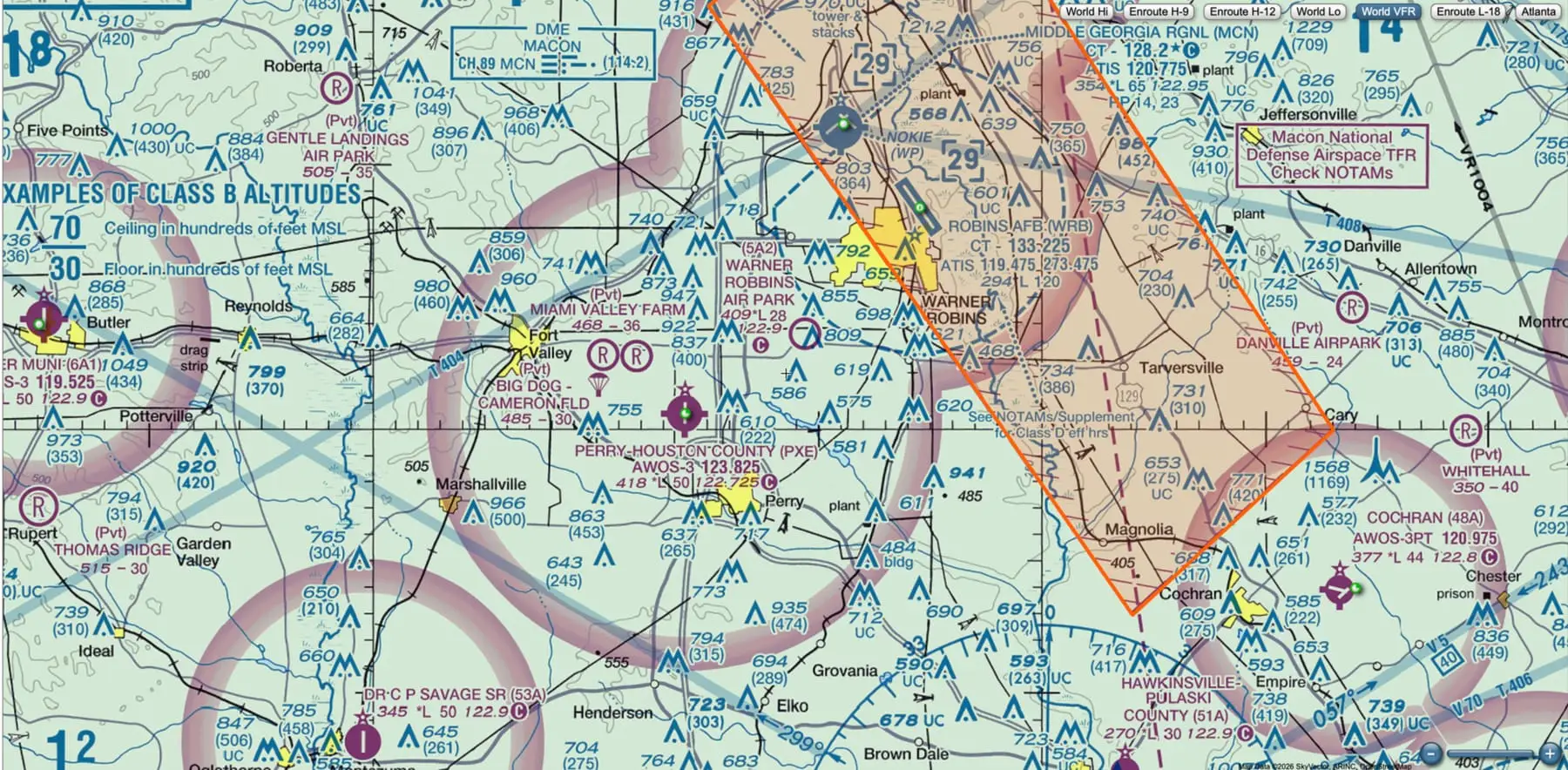
Much of Middle Georgia sits inside controlled airspace around Robins Air Force Base and the regional airports. We check every site before quoting, obtain LAANC or FAA authorizations when they are needed, and do not fly where we are not cleared to.
Weather decisions
Wind, gusts, visibility, ceilings, and precipitation all factor into a go/no-go call. We plan flights around the forecast and reschedule when conditions are wrong. A delayed flight is cheaper than a lost aircraft or a bad dataset.
Mission planning
Objectives, capture pattern, altitudes, launch and recovery locations, battery plan, emergency procedures, and who to call on site. Planning before the flight is what makes the flight itself short and uneventful.
Risk management around people and property
Standoff distances, no flights over uninvolved people, coordination with crews and site contacts, and a visual observer when the operation calls for one. Your site safety rules apply to us as well.
Documentation you can rely on
Flight logs, authorizations, and aircraft maintenance records are kept for every operation. Deliverables are organized and dated so they hold up when someone needs to reference them later.
Have a project? Tell us what you’re trying to accomplish.
A quick roof photo, a recurring site survey, or something nobody has asked us for yet. If aerial imagery or data would help, we’ll figure out how to get it safely.